Is there a difference in characteristics between weekdays newspaper maps and those contained in newspapers in the weekend?

The next partial issue consisted of the temporal one (weekdays vs weekend) and the colour issue. Not only were more maps inserted on Saturdays, they tended to be more colourful as well. The major map theme during weekdays was military conflicts and geopolitics (28); the major map theme during Saturdays was tourism (49%). The latter only accounted for 10% on weekdays; military conflicts and geopolitics accounted for 7% in the weekend.
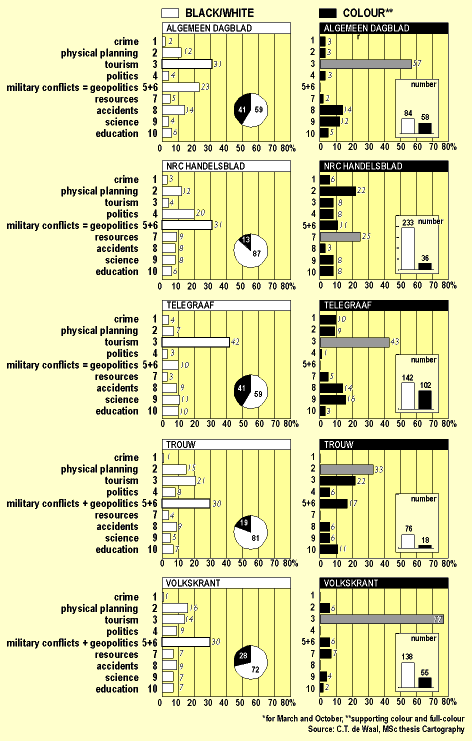
Figure 7 shows the uses made of colour, for the five national newspapers analysed. Coloured maps are usually produced for tourism; it is only the highest quality newspaper, NRC Handelsblad, which has more coloured maps for physical planning and resources; it is joined by Trouw for the first characteristic.
Figure 7 - Newspaper map themes vs colour or black/white
Has there been a geographical trend in the development of newspaper maps?