| XII. 20. | Ramiro Marco Figuera, an Erasmus student from Spain, defends his degree thesis |
| XII. 14. | Buga László, an honorary associate professor of the Department, was awarded the Lazarus Medal by the Hungarian Society of Surveying, Mapping and Remote Sensing |
| XII. 10. | Conference of undergraduate researchers at the Department |
| XI. 29-XII. 3. | Zentai László gave classes and a lecture, "Are we ready for Cartography 2.0? Application of web 2.0 in cartographic education" at the Technical University of Vienna within the framework of Erasmus staff mobility. The CartoTalks was organized by the Cartographic Research Group. |
| XI. 29-XII. 2. | Török Zsolt participates in the Imago Mundi meeting in London |
| XI. 26. | Two professors, Peter Freckmann and Heinz Saler from Karlsruhe University of Applied Sciences, Faculty of Geomatics visited the Department. |
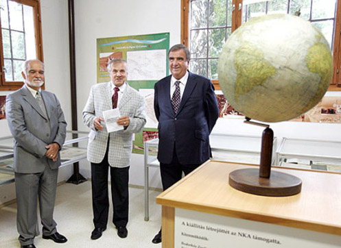
| XI. 25. | Open Day in the National Széchényi Library with the contribution of Gede Mátyás assisted by students Ignácz Dóra and Ungvári Zsuzsanna (organizing and running museum-pedagogical classes related to the exhibition of Hungarian earth and celestial globes), Márton Mátyás (three guided tours of the exhibition), and Nemes Zoltán (taking photographs) |
| XI. 23. | Klinghammer István's inaugural lecture in the Academy |
| XI. 20. | Mészáros János, PhD student participated in the Robotics Day organized by the Faculty of Informatics and Neumann János Computer Society |
| XI. 17. | World Day of GIS at the Department
Bohuslav Veverka, a professor from the Czech Technical University, Prague, visited the Department The City of Budapest awarded the Pro Urbe Budapest Medal to Klinghammer for his outstanding teaching and public role in higher education in Budapest |
| XI. 16. | Within the research project NKTH-TÉT AT-3-09, two teachers from the Cartographic Research Group of the Institute of Cartography and Geoinformation (Technical University of Vienna) gave a presentation and a practical class: Manuela Schmidt: Webmapping 2.0 (in English) Simonné Dombóvári Eszter: Open source code geoinformatic applications on the web (Practical in Hungarian) |
| XI. 12. | Procession with torches from Egyetem tér to Trefort Garden to remember the 375 years of the University |
| XI. 11. | Open Day at the Faculty of Informatics |
| XI. 5-6. | 5th Conference of Hungarian Geographers in Pécs. Papers from the Department: Elek István: Development and experiences with large cartographic databases Török Zsolt Győző: Cartographic information and geographical ontology: Italian surveys of the Libyan Desert in the 1930s Kovács Béla: Georeferencing the maps of the Balkan region Gede Mátyás–Simonné Dombóvári Eszter: Blank map practicals with the virtual globes on the web |
| XI. 4. | Nagy Szabolcs, who graduated as a cartographer in 2009, died |
| XI. 1-30. | Markéta Macková, a student of the Olomouc University, spent a practical month at the Department |
| X. 25-XI. 5. | Jesús Reyes visited the Institute of Cartography and Geoinformatics (Technical University of Vienna) within the framework of the project, "Use of Chernoff faces in school maps - Further research and survey related to the theoretical and practical results of previous international projects about Chernoff faces" supported by the AT-3-09 bilateral research project. He gave a paper, "Alternative solutions for data visualization" at the CartoTalks organized by the Cartographic Research Group on 29 October. |
| X. 24-26. | Klinghammer István and Elek István, accompanied by Kocsis Károly, director of the Geographical Research Institute and two of his colleagues, Keresztesi Zoltán and Farkas Zoltán, visited the Leibnitz Institute in Leipzig. They had discussions with the editors of the German national atlas. |
| X. 20. | Amparo Nunez Andres, a teacher from the Department of Geotechnics and Earth Sciences, Technical University of Barcelona, gave a lecture, "The use of INSPIRE (European Spatial Data Infrastructure) in Spain " within the framework of an Erasmus staff mobility project. |
| X. 15. | Printed Hungarian earth and celestial globes from the beginning to our days. Exhibition organized in the National Széchényi Library with the cooperation of the Department. The exhibition was opened by Klinghammer István. |
| X. 13. | Handing over of the Jubilee degrees for cartographers graduated in 1960 |
| X. 6-10. | Manfred Buchroithner, professor of the Technical University in Dresden visited the Department |
| X. 6. | The King Sigismund College and the L'Harmattan Publishing House started to publish the periodical, Geopolitika a 21. században (Geopolitics in the 21st century). in Hungarian and in English. The maps are made by Zentai László as an external member of the research group. |
| X. 5-17. | Jesús Reyes gave a paper, "Visualización de datos en la formación de universitaria de cartógrafos en Hungría" at the conference, "Congreso Internacional de Geografía del Bicentenario" at the invitation of the Argentine Geographical Association to celebrate the 200th anniversary of the Republic of Argentina. |
| X. 2. | Karsay Ferenc, a former teacher of the Department, died |
IX. 28. |
|
IX. 24. |
Participation of the Department in the Open Day of the Faculty of Science and at the Researchers' Night: GPS in practice; Virtual Globes Museum – Tool for safeguarding cultural heritage and for education. |
IX. 22-24. |
Gede Mátyás and Mészáros János gave a paper, "Georeferencing old survey maps" at the meeting of the project partners of "Environmental monitoring system with GIS for the watershed of the Ipoly River" in Gyűgy (Dudince), Slovakia. Other participants from the Department: Gercsák Gábor, Zentai László. |
IX. 16. |
|
IX. 10. |
Draskovits Zsuzsanna, assistant professor, received the silver award Pro Universitate at the opening ceremony of the academic year. |
IX. 8. |
|
IX. 7. |
New Erasmus students from abroad (for one study period at the university: |
IX. 6. |
Departmental opening of the academic year in Pilismarót. Host: Elek István |
IX. 1. |
Koncz László Géza, 3rd year BSc student of cartography at the Babeş-Bolyai University of Cluj (Kolozsvár) begins his study for one semester at the Department |
VIII. 31. |
Klinghammer István, academician opened the exhibition, From Kapnikbánya to Papua New Guinea in the Museum of Oil in Zalaegerszeg. The maps of Papp Simon, geologist were on display. |
VIII. 30. |
The IAMG (International Association for Mathematical Geosciences) held its 14th annual conference at the Lágymányos Campus of the university. Elek István gave a paper, "An application of fractal geometry to porosity modelling" in the section, "Theoretical geomathematical problems". His poster, "Image processing methods in automatic generalization of digital maps" was also on show. He was the chairman of this section in the afternoon.
Gercsák Gábor participated in the meeting of Hungarian and Slovakian project partners (Environmental monitoring system with GIS for the watershed of the Ipoly River) in Révkomárom (Komarno). |
VIII. 14-19. |
10th world meeting of Hungarian geoscientists in Szombathely. Verebiné Fehér Katalin was a member of the organizing committee. Török Zsolt Győző, associate professor gave a paper, Expeditions of Almásy László: topographic mapping and international borders in the Libyan Desert at the plenary meeting. Ruzsa Ágnes, PhD applicant gave a paper, "Thematic maps in geographical school atlases". Bánfi Róbert's (PhD student) paper, "General and overview topographic maps until World War II by the example of Szombathely and environs". Simonné Dombóvári Eszter's (PhD candidate) paper: "Interactive web mapping in education". |
VIII. 11. |
Zentai László gave a paper, "Automatic derivation of large scale topographic maps from ALS and possible applications for orienteering maps" in Trondheim (Norway) at the 14th International Conference on Orienteering Mapping. Co-author: Georg Gartner, professor in Vienna, vice-president of the ICA. |
VII. 14-25. |
Zentai László, professor, was the leading lecturer of the first week of a workshop at the Technical University of Ho Chi Minh City, Vietnam, organized by the Commission on Training and Education of the ICA. The other lecturer of the module was Vit Vozenilek, Czech professor. Zentai László had two modules, Internet Mapping, and Prepress and Digital Printing. |
VII. 5-11. |
Gercsák Gábor participated in the regional conference of the International Geographical Union in Haifa (Israel), where he gave a paper, "Floods and city planning in Budapest". |
| VII. 14-25. | On a workshop organized by the ICA Commission on Education and Training in Ho Chi Minh City (Vietnam) László Zentai was on of the presenter. The other presenter was Vit Vozenilek (Olomouc University). |
| VI. 28-29. | State exams in the 5-year training |
| VI. 23-25. | BSc state exams |
| VI. 15-20. | José Jesús Reyes Nunez took part in the Third Conference of Cartography and Geoinformatics supported by ICA and organized by the Sofia University of General Engineering, Construction and Geodesy held together with the Central and Eastern European Regional Symposium of the ICA in Nessebar, Bulgaria. He gave a presentation, "Chernoff survey in Argentine and Hungarian Schools", and had a poster, "Collection of Maps made by Hungarian Children". |
| VI. 11. | PhD defense of Gede Mátyás |
| VI. 10. | Zentai László, Head of Department gave a presentation on the MSc training of cartographers at the Faculty forum on education |
| VI. 9. | Jon Oroz, a student of the Basque University, defends his degree thesis, "Updating a map of Városliget with vegetation data" |
| VI. 7. | PhD defense of Irás Krisztina |
V. 13. |
Neumann Day at the Faculty of Informatics. Jesús Reyes gave a paper, "Large scale cartographic databses and the informatics of thematic cartography". |
V. 10. |
Exhibition, „The river that sustains and connects – the Danube" opens in Esztergom. Török Zsolt represented the Department and gave the introductory paper. He also took part in the prarations. |
V. 5. |
|
V. 2-5. |
Mészáros János, PhD student took part in the conference of the European Geosciences Union General Assembly 2010 in Vienna. He had a presentation, "The Danube Mappation of Hungary (1823-45) and its georeferencing method". |
| V. 3. | Prof. Klinghammer István, is elected a full member of the Hungarian Academy. Pápay Gyula, Professor Emeritus of the Rostock University, a former student of ELTE, an invited lecturer of the Department, is elected an external member of the Hungarian Academy. |
| IV. 30. | Gercsák Gábor gave a paper, "English exonyms of geographical names of Hungary" at the UNGEGN Working Group on Exonyms, in Vienna. |
| IV. 29-V. 2. | Zentai László gives lectures in Sofia in the frame of the Erasmus teacher mobility programme. |
| IV. 25.-VII. 30. | A chamber exhibition, "Maps in education – training cartographers" was opened in the Professors' Club of the university on the occasion of the 375th anniversary of foundation. The documents were exhibited from the collection of the Department and of the University Library. |
| IV. 19-24. | Márton Mátyás gave lectures in Cluj-Napoca in the frame of the Erasmus teacher mobility programme. |
| IV. 12. | Flávio Paulo Jorge Nunes, teacher at the Minho University in Portugal, gave a lecture in English on the following topics (in the frame of the Erasmus teacher mobility programme): Portugal: a portrait of an European peripheral country; Cyberspace: the new frontiers of Geography; Information and Communication Technologies and new territorial dynamics |
| III. 31. | Zentai László gave lectures in the Czech Republic (Palacky University, Olomouc) in the frame of the staff mobility programme of CEEPUS |
| III. 19. | PhD defense by Danku György |
| III. 12. | The minister of agriculture and rural development awarded the Fasching Antal Medal to Klinghammer István on the national day of Hungary respecting his outstanding role in the development of geodesy, land administration and cartography. PhD defense by Havas Gergely |
| III. 10. | Professor Heinz Musall from Germany (Heidelberg, Karlsruhe) visits the Department |
| III. 1. | Martinl Klicha, a Czech student (from Olomouc) spends a semester at the Department within the frame of the CEEPUS programme |
| II. 25. | Meeting of the Hungarian National Committee of the ICA at the Department |
| II. 22-24. | 5th International Workshop on Digital Approaches in Cartographic Heritage, Vienna. Participants from the Department: Gede Mátyás, Gercsák Gábor, Zentai László; Mészáros János (PhD student) and Ungvári Zsuzsanna (student). |
| II. 19. | PhD defense of Matula Györgyi |
II. 3. |
Jon Oroz Santamaria, an Erasmus student from the Basque University prepares her degree thesis at the Department |
I. 28-29. |
|
I. 26-27. |
State examinations (BSc, 5-year training), Defense of the degree thesis of Adrian Cuesta Pou, a Basque Erasmus exchange student |
I. 5. |
PhD defense of Albert Gáspár |