XII. 15. |
|
XII. 14. |
PhD defence of Merve Senem Arkan Presentation of a new book: Printed Hungarian Terrestrial and Celestial Globes written by Plihál Katalin, who gives classes at the department. The book was published by the Zrínyi Publishing House and introduced by Klinghammer István. |
XII. 9. |
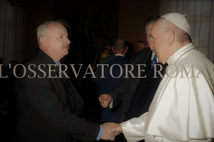
Scientific Day of Cartography in the Hungarian Academy. Török Zsolt, associate professor, gave a lecture in Rome in a meeting of the International Catholic Rural Association (ICRA). The event was Strategy Europe 2020: The role of social dialogue for a sustainable agriculture and the growth of employment. His lecture: Sustainable Agriculture and Employment Growth Today in Europe. After the event, he was received at a private audience of the Pope in the Vatican. |
XII. 8-9. |
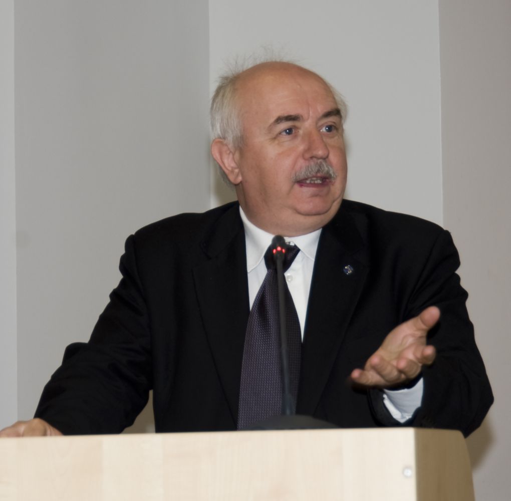
Georg Gartner (Technical University of Vienna), former president of the ICA, visited the department. He gave a paper in the meeting of the Cartography Section of the Hungarian Society for mapping, Surveying and Remote Sensing and in the Scientific Day of Cartography. |
XII. 6. |
Celebration of St. Nicolas Day organized by 3rd year BSc students. |
XII. 1. |
|
XI. 24. |
Gede Mátyás represented the department at the 5th open source geoinformatics meeting of the Foss4G.HU. His paper: Country Movers - Caesium-based planetary cartographic demonstration aid. |
XI. 3. |
8th Cartographic Science Congress, Buenos Aires, National Geographic Institute. Zentai László gave a paper: Modern cartography according to the International Cartographic Association |
X. 27. |
Zentai László gave a paper in the International Conference on Cartographic Visualization of Big Data for Early Warning and Disaster/Crisis Management, in Nanking, China. His paper: Challenges of Modern Cartography. |
X. 25. |
Jubilee diploma for cartographers who got their degree in 1966 |
X. 20-21. |
Aerial Cartographic and Remote Sensing conference at the University of Óbuda. Mészáros János had two posters here. |
X. 17-18. |
Jesús Reyes represented the department at the Xth Coloquio Internacional de Estudios Hispánicos organized by the ELTE Department of Spanish Studies and Latin American Research Centre in Budapest. His paper: "Utopías y leyendas en la cartografía del Nuevo Mundo". |
X. 14. |
ELTEFESZT. Papers from the department: |
X. 13-15. |
6th International Symposium on the History of Cartography. The paper by Török Zsolt Győző: Revising, rectifying and regulating the Danube. Merve Arkan, PhD student: Invariable image of Cyprus: Reproduction of siege maps of Nicosia and Famagusta |
X. 13-14. |
Innovative and geoinformatical developments and prospects in archaeology - conference in Lakitelek. The department was represented by Mészáros János, who had a poster: Using drones to survey archaeological sites in the area of Bodajk. |
X. 13. |
GDi Esri Hungary Users Conference in Budapest. The department was represented by Jesús Reyes’s poster: “Children Map the World”. |
X. 6-7. |
Light-Space-Image conference in Velence. Papers from the department: dr. Mészáros János, dr. Koós Sándor, Deák Márton, Árvai Mátyás, Takács Katalin, dr. Pásztor László: First experiences with the Cubert hyperspectral camera on board an octocopter. |
| IX. 30. | Night of researchers. The programmes of the department received more guests than ever before. Our programmes:: Find your way in the campus! Make your own globe! (4 groups) Visit to the visualization centre (6 groups) Our organizers and presenters: Gede Mátyás, Ungvári Zsuzsanna. Helping regular and PhD students: Luzsi Péter, Vörös Fanni, Barancsuk Ádám. |
| IX. 26. | Winners of the Rector’s Grant of Excellence: Gede Mátyás and Zentai László. |
| IX. 20. | UNESCO university sports day. ELTE campus orienteering race. Our participants: Albert Gáspár, Gede Mátyás, Ungvári Zsuzsanna, Zentai László, and Kovács Béla and Mészáros János (with their children). Winner of the race on medium field: Albert Gáspár. 5vös 5km run race. Our participants: Albert Gáspár, Gede Mátyás, Irás Krisztina, Ungvári Zsuzsanna. Winner in the category of university teachers: Gede Mátyás. |
| IX. 19-23. | Elek István gave a paper in the artificial intelligence section of the SAI Intelligent Systems Conference 2016 in London. His paper: Can the intelligence emerge spontaneously in not biological, artificial world? |
| IX. 15. | The department participated in an exhibition organized by the University Library and the Hungarian Foundation for Information Technology. The Library of the Faculty of Informatics was represented by Németh Gabriella and Szabó Tibor, the library of the department by Kiss Tünde. |
| IX. 14-16. | AutoCarto conference in Albuquerque, USA. The department was represented by Gede Mátyás. His paper: Mátyás Gede-Henrik Hargitai: 3D Webcartographic Tools for Planetary Science Outreach. |
| IX. 10-17. | Jesus Reyes took part in an Erasmus teacher mobility in Vitoria-Gasteiz, Spain. He a gave course, “Soluciones actuales en la geovizualización de datos” at the Engineering Institute of the Basque University for the BSc students of geomatics and topography. |
| IX. 5-I. 31. | Incoming Erasmus students: Jon Guinea Vitorica (Bilbao), Ladislav Rozkosny (Olomouc). |
| IX. 1-2. | Zentai László gave a workshop paper in the ETH (Zurich) at an ICA conference (Commission on Atlases, Commission on Education and training): 60 years of a university cartography programme |
| IX. 1. | We start the English language cartography MSc for the first time |
| VIII. 30. | Departmental opening of the new academic year in Pilismarót |
| VIII. 25-27. | The first event of the Hungarian Geographical Days at the Eszterházy Károly University in Eger. Two representatives from the department: - Jesús Reyes, in the section on Cartography and Geoinformatics: “The influence of a Hungarian cartographer on teaching geography in Cuba (1929-1959)”. - Ungvári Zsuzsanna, in the section on Teaching Methods and Geography Teachers, written jointly with Irás Krisztina: “Szertár.elte.hu – old demonstration aids in geography in new dress”. Two of our PhD students reported on their research: - Szabó Renáta (Geographical Research Istitue of the Academy) in the section on Cartography and Geoinformatics, “The bordering of seas by GIS”. - Dékány Krisztina (II. Rákóczi Ferenc Secondary School), in the section on Teaching Methods and Geography Teachers, “Geoinformatics in teaching”. |
| VIII. 21-25. | Gercsák Gábor participated in the 33rd international conference of the IGU. |
| VII. 14. | Zentai László gave a paper in Ibarra, Ecuador, at the Pontificia Universidad Católica del Ecuador: Cartography 2.0 – Maps of the 21st century. |
| VII. 12. | Márton Mátyás was a member of the examination board at the open defence of Dr. Imecs Zoltán in Kolozsvár (Cluj-Napoca), at the Babeş-Bolyai University. This board approved his application for the title, associate professor. |
| VII. 1. | Mészáros János became an assistant professor. |
| VI. 29-30. | State exams of the MSc students |
| VI. 28-IX. 28. | Elena Zapatero Cabañas, teacher of the Alcalá de Henares University visited the department. She continues doctoral research studies on “Mathematics in disciplines and its teaching”. |
| VI. 23-27. | Gercsák Gábor participated in the session and field trip of IGU’s working group Comland in Slovenia. His paper: The development of a lake after landslides. |
| VI. 29-30. | MSc state exams |
| VI. 23-27. | Gercsák Gábor participated in the session and field trip of IGU’s working group Comland. His paper: The development of a lake after landslides. |
| VI. 20-21. | |
| VI. 13-17. | 6th International Conference on Cartography and GIS in Albena, Bulgaria. Papers from the department: |
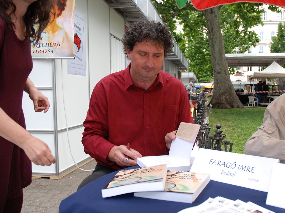
| VI. 9-13. | A book by Faragó Imre: Ber, Bere, Berény (naming places in the Carpathian region) was published for the Book Week |
| VI. 6-7. | On the evolution and origin of Portolan charts – first conference on portolans in Lisbon. Paper by Irás Krisztina: Central Europe on portolan charts. |
| VI. 3-4. | 3rd ISHMap Symposium in Lisbon. Paper by Török Zsolt: From the Rivers to the Ocean: Marsigli’s Maps in the Shadows of the Enlightenment. |
| VI. 3. | Zsoldi Katalin presented her PhD at the department before defending it. |
| VI. 1-2. | |
| VI. 1. | Visit of the students of the Benedictine School of Győr at the department in the frame of the International Map Year. |
| V. 26-27. | 7th Conference and Exhibition on GIS in Debrecen. Papers from the department: |
| V. 22-28. | Márton Mátyás gave lectures as an Erasmus exchange professor in Kolozsvár / Cluj at the Babeş-Bolyai University. Topics of the course on atlas cartography and on the Virtual Globes Museum: |
| V. 11. | Orienteering race at the campus. Participants: Albert Gáspár, Gede Mátyás, Ungvári Zsuzsanna, Zentai László. |
| V. 6. | Klinghammer István became professor honoris causa of the university: http://www.elte.hu/hir?id=NW-8530 |
| V. 5. | ELTE 5vös 5 km race at the campus. Our participating teachers: Gede Mátyás, Irás Krisztina, Ungvári Zsuzsanna. |
| V. 3. | Neumann Day at the Faculty of Informatics. Presentation by Klinghammer István, the new professor of honoris causa: The model principle of cartography. |
| V. 2-8. | Albert Gáspár in Sofia in the frame of Erasmus exchange. |
| IV. 25. | Hussein M. Alquadi, researcher at the GIS Department of Dubai Municipality visited the department. Bartos-Elekes Zsombor Erasmus visited the department in Erasmus exchange. He gave a paper in the Lázár Kollokvium (joint organization with the Cartographic Section) |
| IV. 20-22. | 11th International Workshop on Digital Approaches to Cartographic Heritage in Riga.
Gede Mátyás chaired Section 1 (Preamble). |
| IV. 20-21. | Zentai László gave two lectures in Novosibirsk in the InterCarto-GeoSiberia 2016 congress: From Paper Maps to Open GIS: the Way to Cartography 2.0 at the Geological and Geophysical Institute of Hungary and The role of International Cartographic Association |
| IV. 20. | The Day of Surveyors of the Capital and Pest County to remember the 60th anniversary of the establishment of the Hungarian Society of Geodesy, Cartography and Remote Sensing. The department was represented by Buga László and Márton Mátyás (programme). |
| IV. 17-22. | general Assembly of the European Geosciences Union in Vienna. Papers from the department (Magyar Zoltán and Vörös Fanni are BSc students):
|
| IV. 11. | |
| IV. 1. | |
| III. 17. | Day of European Surveyors and GIS scientists in Budapest. Papers by Zentai László: a Cartography 2.0: maps in the 21st century. |
| III. 14-18. | Jesus Reyes gave a paper, Past, present and future of cartography for children in La Habana at the 9th International Conference on Geomatics. He chaired a workshop on Cartography for children or school mapping: geovisualization in theory and in practice. |
| III. 4. | |
| II. 5. | Gede Mátyás received the award, Promising Researcher of ELTE |
| II. 1. | Jorge Marques, an Erasmus student from Portugal spends a semester at the department; Kristina Kehayova, an Erasmus student from Bulgaria extends her study period here by another semester |
| I. 29. | |
| I. 28. | |
| I. 26. | |
| I. 25. |