| XII. 15. | Zentai László participates in the congress of the Indian National Cartographic Association in New Delhi. He gives the Todar Mal memorial lecture: Modern Cartography according to the ICA: towards cartography 2.0. |
| XII. 14. | Departmental conference on student research. Horváth Balázs (MSc student of geography): Analysis of strategic noise maps of main roads by integrated GIS (Consultant: Gede Mátyás). Mezei Gáspár (MSc student of cartography): Geographical names around the mouth of the Ipoly river (Consultant: Faragó Imre) |
| XII. 11. | Zentai László gives a presentation in the 9th conference of Mobile Mapping Techniques in Sydney, Australia Cartography 2.0: visualization of spatial tracking data in sport. Also he is a chair of the section on LBS. |
| XII. 1. | In the Petőfi Museum of Literature, Gercsák Gábor presented the book of Takács Péter: „The name of the rose: Hungary. On the names of states and the renaming of Hungary”, published by Gondolat. |
| XI. 26. | Gercsák Gábor represents the Hungarian National Committee on Geographical Names in a regional meeting of the United Nations Group of Experts on Geographical Names in Ljubljana, Slovenia. He gives two papers: „Report of Hungary 2012–2014” and „Does Google serve as a model of using place names?” |
| XI. 25. | On the faculty event of the Hungarian Science, Gede Mátyás is one of the presenters with 3D surveying and visualization of caves |
| XI. 19. | Open Day of the Faculty of Informatics
|
| XI. 18. | Márton Mátyás gives a paper, Tectonic globe and detachable structural-morphological earth model – interesting demonstration tools of earth sciences in the Virtual Globes Museum. |
| XI. 17. | Gercsák Gábor gives a presentation, A geographer in Tasmania. Geographical mosaics from a remote island of the southern hemisphere in the Hungarian Geographical Museum, Érd. |
| XI. 11. | Book presentation in the Hungarian Society for the history of Medicine. The book, Johannes Honterus: Rudimenta Cosmografica was originally published in four languages in Bonn and Nagyszeben (Sibiu). One of the reviewers is Török Zsolt |
| XI. 10-12. | EuroCarto conference in Vienna. Presentations from the department: Györffy J.: Some Remarks on the Question of Pseudocylindrical Projections with Minimum Distortions for World Maps Barancsuk Á.: A Semi-automatic Approach for Determining the Projection of Small Scale Maps based on the Shape of Graticule Lines J. Reyes: A Forgotten Atlas of Erwin Raisz: “Atlas de Cuba” Zentai L.: The Effect of the Political Transition of Hungary on Map Publishing Posters: J. Reyes: Results of the Barbara Petchenik Children’s World Map Drawing Competition Kiss T.: Changes of Landscape in the Sió-Sárvíz Valley (Transdanubia, Hungary) due to Human Activity. Analysis of Old Maps and Historical Data Ungvári Zs.-Irás K.: Web-based Reconstruction of Old Educational Instruments of Geography Szigeti Cs.-Albert G.: Measuring the Adequacy of Maps for Field Use Gede M.-Ungvári Zs.-Kiss K.-Nagy G.: Open-source Web-based Viewer Application for TLS Surveys in Caves J. Reyes: Results of the Barbara Petchenik Children’s World Map Drawing Competition The Cartoheritage section is chaired by Zentai László |
| XI. 6-13. | Ungvári Zsuzsanna spent a week as an Erasmus exchange teacher at the Technical University of Vienna |
| X. 29-30. | Light-Space-Image conference in Gyöngyös |
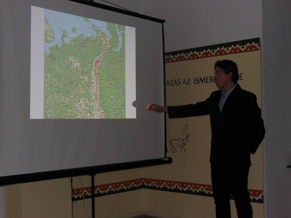
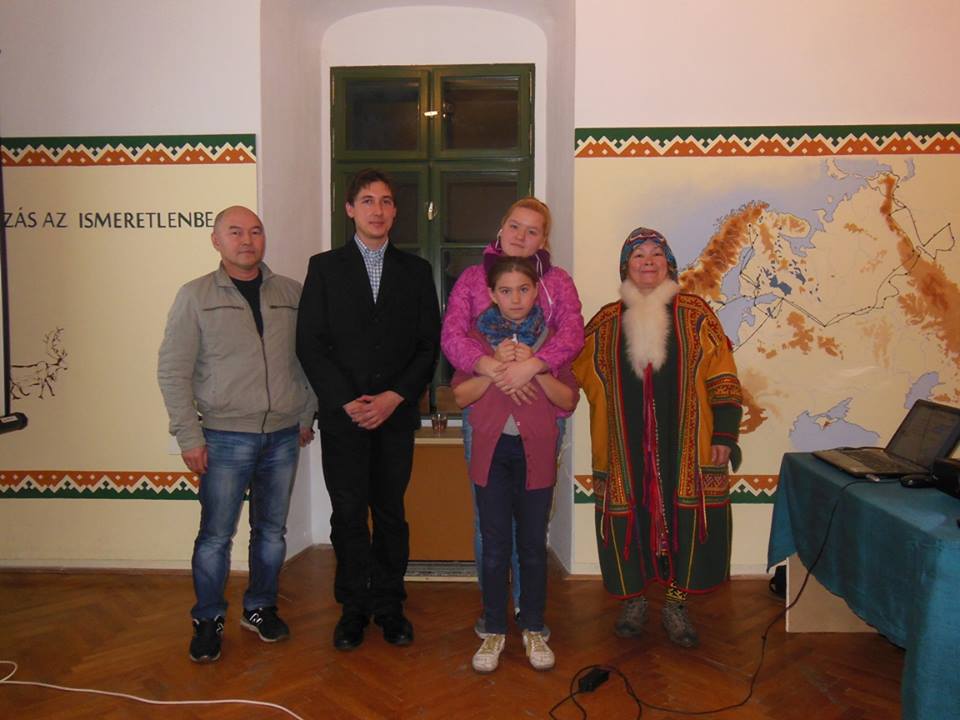
| X. 15. | Gulyás Zoltán, PhD student gave a lecture in the Reguly Antal Museum in Zirc, as a part of a series of lectures in the Day of Related Peoples – Finno-Ugric Cultural Festival. His paper: Mapping and Heritage – The lifework of Reguly Antal seen by a cartographer (pictures: 1, 2) |
| X. 6. | Campus orienteering race. Participants from the teachers: Albert Gáspár, Gede Mátyás, Kovács Béla, Zentai László; PhD participant: Barancsuk Ádám |
| X. 2. | ELTEfest faculty programme. Presentation by Gede Mátyás: 3D surveying and visualization of of caves |
| IX. 28. | Eötvös 5 km run race. Participants from the teachers: Albert Gáspár, Gede Mátyás, Irás Krisztina, Ungvári Zsuzsanna. Gede Mátyás was the fastest among teachers; Gulyás Zoltán, PhD student was third among PhD students |
| IX. 25. | The night of researchers. Programme by the department: Build a globe! |
| IX. 17. | Gulyás Zoltán, PhD student participated in a conference on the history of science in the Hungarian Geographical Museum, Érd. His paper: Modern cartographic processing of the manuscript map of Reguly Antal |
| IX. 12-19. | Jesus Reyes spent a week as an Erasmus exchange teacher at the Geography Department of the University of Valencia in Spain |
| IX. 3-XII. | Kristina Kehayova Erasmus student from Sofia spends a semester at the department |
| IX. 2. | Departmental opening the academic year in Pilismarót. |
| VIII. 30-IX. 2. | Eugeo conference in Budapest. Presentations from the department: László Zentai*, Andrea Pődör, András Révész: Crowdsource noise map for Hungarian small towns José Jesús Reyes Nunez, Barbara Juhász, László Zentai*: Testing the use of cartograms in Hungarian schools A Ubiquitous Cartography – The Crowdsourced Geographic Information Used in The section, “GIScience” is chaired by Zentai László. |
| VIII. 23-28. | 27th international cartographic conference in Rio de Janeiro. Presentations from the department: Hargitai, H.; Gede, M.; Zimbelman, J.; Kőszeghy, C.; Sirály, D.; Marinangeli, L.; Barata, T.; López, I.;: Multilingual narrative planetary maps for children Gede, M.: Thematic Maps on Virtual Globes Irás, K.; Nguyen Thai, B.: Positioning and Spatial Search of Maps with undeterminable Projections Reyes Nunez, J.J.; Juhász, B.: Hungarian Survey on the Use of Cartograms in School Cartography Harkányiné Székely, Z.; Waltner, I.; Vekerdy, Z.; Zentai, L.: Selected Examples of Potential Early Cartographic Data Sources for the Carpathian Basin Pődör, A.; Zentai, L.; Révész, A.; Dobos, M.: Thematic Maps in Analysing the Prejudice and Preconception in the Fear of Crime of Citizens of a Typical Hungarian Small Town Zentai, L.: Generalization Problems of Orienteering Maps Faragó, I.; Jeney, J.: Landscape Systems in Cartography Jeney, J.: Ethnic Map of Hungary by Jenö Cholnoky Posters: Ungvári, Z.; Gede, M.: Estimation of the real elevation values on flood basins and lowlands based on SRTM and CORINE data Albert, G.; Ungvári, Z.; Merk, Z.; Gede, M.: Map of ancient tectonic forces on Mars - Visualization of a global stress-field model based on the new geologic map of the Red Planet Castreghini de Freitas, M.I.; Reyes Nunez, J.J.: Course on Geovisualization at the Paulista State University, Rio Claro (Brazil) Kis, R.; Czifra, M.; Gede, M.: Literature History and Cartography – Kazinczy’s Correspondence and Its Cartographical Demonstration Jeney, J.: Problems Caused by Generalisation on Ethnic Maps Jeney, J.: Ethnic Maps in the Workers Atlas by Alexander Radó Section chairs: Gede Mátyás: Cartographic Heritage 4 Jesus Reyes: Cartography and Children 2, Zentai László: Geointelligence and Crime Maps, Orienteeing Mapping Jesus Reyes was awarded by the Diploma for Outstanding services to ICA. The 16th General Assembly re-elected Zentai László for another four years as Secretary General of the International Cartographic Association. Gede Mátyás was asked to act as vice-chairman of the Commission on Cartographic Heritage into the Digital. |
| VIII. 21-22. | Cartography beyond the Ordinary World workshop in Niteroi, Brazil. The event was coordinated by Jesus Reyes. Presentations from the department: Zentai László: Cartography 2.0 - are we there? (keynote) Gede Mátyás-Hargitai Henrik: Country movers – an Extraterrestrial Geographical Application José Jesús Reyes Nunez, Maria Isabel Castreghini de Freitas: Short course on Map-based Geovisualization at the São Paulo State University Irás Krisztina: From Thematic Maps to GIS – in School Cartography Section chair: Jesus Reyes |
| VII. 12-15. | 26th International Conference on the History of Cartography. The department was represented by Merve Arkan, PhD student. Her paper: Story of a city under siege (1570-1571): Stephano Gibellino’s map of Famagusta |
| VII. 3. | Itinerary Congress of the Hungarian Society for Surveying, Mapping and Remote Sensing in Szolnok. Presentations from the department: Zentai László: International Map Year 2015-16 Barancsuk Ádám: Automatic recognition of projections on the basis of grid lines Szigeti Csaba: Measuring the understanding of cartographic information |
| VI. 30. | Annual summer conference of the Association of Ecclesiastic Libraries in Sárospatak. The department was represented by Ungvári Zsuzsanna. Her presentation: Digitizing maps. |
| VI. 29-30. | Final exam of MSc students |
| VI. 22-24. | Final exam of BSc students |
| VI. 19. | International Erasmus students defend their degree thesis |
| VI. 18. | Annual research report of PhD students |
| VI. 28. | Zentai László gave lectures in Port of Spain (Trinidad and Tobago) at the University of West Indies |
| V. 28-29. | Sixth GIS conference in Debrecen. Papers from the department: Kohán Balázs–Eisam-Eldeen Fatima–Iván Veronika–Horváth Erzsébet–Mészáros János–Sik András–Jakab Gergely–Szalai Zoltán: Study of the development of gullies using UAV equipment in Kistés and Somogybabod Kis Réka–Gede Mátyás: Visualizing the correspondence of Kazinczy by Google tools Ungvári Zsuzsanna: Determining real absolute elevations above under forest cover on the basis of SRTM and CORINE data Szabó Renáta (PhD student): Virtual representation of an 18th century Valk globe Olasz Angéla–Kristóf Dániel–Binh Nguyen Thai (PhD students): Big geospatial data processing |
| V. 27-29. | 10th International Workshop on Digital Approaches to Cartographic Heritage, Corfu Island (Greece). Papers from the department: Zentai L., Cartactual, something special to preserve (and make publicly available) as a Cartographic Heritage: from paper maps to Cartography 2.0; Gede M., Barancsuk Á, Determining the projection of small scale maps based on grid line shapes. Gede Mátyás chaired the Aerial Photography session |
| V. 21. | David Fairbairn, former General Secretary of the ICA, teacher of the University of Newcastle visited the department. He gave a paper, Can VGI be integrated with official map data? |
| V. 20. | General Assembly of the Hungarian Society of Surveying, Mapping and Remote Sensing. Results of the elections are as follows. Deputy secretary general: Buga László; head of the Hungarian National Committee of the ICA, chairman of the Division of Cartography:Gede Mátyás, secretary Szabó Renáta (doctoral student at the department); chairman of the Division of the History of Cartography: Török Zsolt; member of the board: Zentai László. |
| V. 17. | Zentai László gave a keynote lecture, ICA’s modern cartography: Support for Infrastructure of Sustainable Development at the 22nd conference on geomatics in Tehran |
| V. 18. | Trip of the department to the Pilis Mountains |
| V. 8-9. | Kovács Béla and Zentai László participated in the 11th Conference on Cartography and Geoinformatics in Buzet, Croatia |
| V. 7. | Neumann Day in the Faculty of Informatics. Outstanding Teacher of the Faculty Award: Elek István and Faragó Imre. Outstanding Student of the Faculty Award: Barancsuk Ádám and Szigeti Csaba. The research projects of the department were presented by Gede Mátyás. Szigeti Csaba presented his student research paper (placed 2nd in the national competition). Awards of the Barbara Petchenik map competition for children were handed. |
| V. 5. | Teachers in the 5vös 5 km run race: Albert Gáspár, Gede Mátyás, Irás Krisztina, Ungvári Zsuzsanna. |
| IV. 26-30. | Bartos-Elekes Zsombor, an Erasmus visiting associate professor of the Babes-Bolyai University from Cluj-Napoca / Kolozsvár, gave a paper on Kolozsvár a térképeken (Cluj-Napoca on maps). |
| IV. 20. | Czifra Mariann, literary historian, presented her book on the correspondence of Kazinczy Ferenc in the library of the Academy. The presentation was supported by maps prepared by Kis Réka, PhD student. |
| IV. 16-18. | National conference of student research in physics, earth sciences and mathematics was organized in Cluj-Napoca / Kolozsvár, Romania. We had two students in the section cartography and geoinformatics. Szigeti Csaba: A quantitative estimation of the legibility of maps; Kiss Judit: Survey of the use of map symbols among schoolchildren in the 4th, 5th and 7th classes. Szigeti Csaba was awarded 2nd place. First place in this section went to geography student Segyevy Dániel Zoltán (A forgotten milestone in the history of science – Ethnographic map of Hungary at 1:200.000). One of his tutors was Török Zsolt Győző. |
| IV. 14-16. | Arlete Correia Meneguette, teacher from the Universidade Estadual Paulista, Faculdade de Ciencias e Tecnologia, Departamento de Cartografia, Sao Paulo, Brazil, held a short course for master and doctoral students, Cartography based on Google tools. |
| IV. 10. | Tóth Ágoston Club of Seniors of the Hungarian Society of Surveying, Mapping and Remote Sensing visited the department |
| IV. 1. | Orienteering competition at the campus with participants from the department: Albert Gáspár, Gede Mátyás teachers, and Barancsuk Ádám student |
| III.30-IV.3. | Márton Mátyás gave a short course on atlas cartography in the Hungarian Institute of the Babeş-Bolyai University in Cluj-Napoca / Kolozsvár, Romania. |
| III. 28–IV. 2. | As an Erasmus exchange teacher, Gercsák Gábor gave classes on technical translation for students of English in the Sapientia University of Transylvania, in Targu Mures / Marosvásárhely. |
| III. 27. | Opening of the Beautiful Hungarian Map exhibition and competition |
| III. 20. | Zentai László gave a paper Web 2.0 in Cartography in a cartographic workshop Capetown, South Africa |
| III. 19. | Jesus Reyes gave a paper on the International Year of Maps at the Day of European Surveyors and Geoinformatics of the Hungarian Society of Surveying, Mapping and Remote Sensing. |
| III. 11. | Török Zsolt Győző gave a presentation in the Jókai Club: Vasco de Gama and the roads to the Indies |
| II. 20. | Zentai László partcipated in the preparatory meeting of a Horizon 2020 project in Munich |
| II. 18. | Török Zsolt Győző gave a paper in the Lívia Villa of the Jókai Club: AThe Hungaraian explorer of the unknown Sahara: László Almásy |
| II-VII. | Incoming Erasmus students: Vitoria (Bilbao University): Raquel Geijo Barcelona (Catalunya Technical University): Mónica Gimeno and Elena Mestre |
| II. 1. | Alex Boava Meza, Brazilian student involves in the one-year-postgraduate study program at our department. |
| I. 30. | Open Day at the Faculty of Sciences |
| I. 29. | Open Day at the Faculty of Informatics |
| I. 27. | Final exams at MSc level and in the 5-year training |
| I. 26. | BSc final exams |
| I. 22. | Georg Gartner, president of the ICA visits the department
|
| I. 21. | Elek István gave a paper in the Lázár Colloquium: Introduction to the use of Latex 2e. |
| I. 20. | Formation of the Cartographic Sub-commission within the Division of Earth Sciences of the Hungarian Academy with President Zentai László and Secretary Jesus Reyes. |