| XI. 29. | Presentation by Elek István at the Lázár Kollokvium
Zentai László gave a presentation, Topographic and tourist maps 1925–1948, at the conference on Ripszám Henrik and the beginnings of orienteering in Hungary until 1948 |
XI. 22. |
Issue 2013/47 of Élet és Tudomány (Life and Science) published a two-page interview (Orienteering and cartography) with Zentai László |
XI. 21. |
|
XI. 20. |
Elek István had a presentation, Topology with relational database management at the ELTE GIS Day. Mesterházy Anna, MSc student had a presentation, Results of town rehabilitation in Józsefváros. |
XI. 18. |
|
XI. 15. |
The November 2013 issue of GIM International published a one-page report (Outstanding cartographers) on cartography in Hungary. |
XI. 8. |
|
XI. 3-10. |
Márton Mátyás gave an intensive course on Oceanography in the Babeş–Bolyai University in Kolozsvár (Cluj-Napoca) for fifteen second year BSc students. He continued his Erasmus staff mobility programme by giving lectures on Atlas cartography (part of the Thematic cartography course) for about thirty second year MSc students. The subject included the study of thematic representation methods in the historical atlases Atlas of Central Europe and Events of 1956. |
X. 7-9. |
|
X. 7. |
|
X. 4. |
|
IX. 28-29. |
The Department participated in an event popularizing earth sciences in the main building of the Hungarian Institute of Geology and Geopphysics. |
IX. 27. |
The Night of Researchers. EEvents by the Department: |
IX. 25. |
|
IX. 19-20. |
Digital technologies to Cartographic Heritage workshop in Rome Papers from the Department: Krisztina Irás, István Elek, Digital Map Collection and Map Database of the Eötvös Loránd University László Zentai: The way to Cartography 2.0: The implementation of the Digital Technologies in Cartographic Heritage in Cartography and in the ICA Participants from the Department: Irás Krisztina, Jeney János, Zentai László. Light-space-image conference iin Gyöngyös. Participant: Mészáros János. |
IX. 19. |
Gercsák Gábor and Márton Mátyás were invited members of a board evaluating the application of Bartos-Elekes Zsombor for the position of Associate Professor at the Babes-Bolyai University in Kolozsvár (Cluj-Napoca) |
IX. 13. |
|
IX. 7-13. |
Jesús Reyes visited Porto and Guimaraes in the framework of Erasmus staff mobility. He gave lectures at both universities: "Um método alternativo de representaçao na Geografia: os cartogramas ou mapas anamórficos" (An alternative representation in geography: distorted cartograms – anamorphic maps). |
IX. 6. |
|
IX. 2.- |
Incoming Erasmus students: |
IX. 1. |
Györffy János goes to pension |
VIII. 25-30. |
International Cartographic Conference 2013, Dresden
Posters:
|
VIII. 24-30. |
Zsoldi Katalin and Ungvári Zsuzsanna PhD students received grant from the Campus Hungary to participate in the international cartographic conference. |
VIII. 23-24. |
Workshop on Eye Tracking: Why, When, and How? in Dresden organized by the Commissions on Geovisualization and Users. Paper by Bérces Ádám and Török Zsolt: A home‐made, 10 bucks eye tracking system Workshop on Generalisation and Map Production in Dresden organized by two Commissions (Generalisation and Multiple Representation, Map Production and Geo-Business). Presenntation by PhD student Ungvári Zsuzsanna (Zs. Ungvári-N. Agárdi-L. Zentai: A comparison of methods for automatic generalization of contour lines generated from digital elevation models). |
VIII. 23. |
Sharing knowledge symosium in Dresden (organized by four ICA commissions, led by Jesús Reyes: Children and Cartography, Training and Education, Planetary Mapping, Maps for the Blind and Visually Handicapped). Section chairs from Hungary: Hargitai Henrik, Jesús Reyes, Zentai László. |
VIII. 22-23. |
Workshop on Historical Maps, Atlases and Toponymy in Leipzig. Paper from the Department by PhD student Jeney Jánosin the joint meeting of the Commissions on Map History Atlas Cartography: Relation of toponymy and minorities living in the Vojvodina Region in the beginning of the 20th century. |
VII. 11-13. |
Annual meeting of the Hungarian Society of Geodesy, Cartography and Remote Sensing was held in Sopron. Presentations from the Department: |
VII. 1-2. |
|
VI. 27. |
|
VI. 24-26. |
|
VI. 24. |
Presentation of the book, Tabula Hungariae written by Plihál Katalin (teacher of the PhD school). Reviewed by Klinghammer István in the National Széchenyi Library. |
VI. 17. |
Horváth Ildikó, counsellor, leaves the Department for a year in the Ministry of Human Resources. The secretary of the Department for a year is Hillier Domonkos, PhD student |
VI. 11. |
The Department of Hungarian Language and its Research Group on Terminology of the Károli Gáspár Reformed University, the Institute of Hungarian Language and Finno-Ugric Studies of Eötvös Loránd University, and the Hungarian Society of Linguistics organized a workshop, Onomastics and terminology 2. |
VI. 10. |
Albert Gáspár was the co-author of a presentation, Results of structural-geological research in Hungary and international trends, given at the scientific session International trends and Hungary: Sedimentology and Structural-geological Research organized by the Hungarian Academy Professors Márton Mátyás and Zentai László represented the Department at the first editorial meeting of the Hungarian National Atlas project |
V. 31. |
Annual reports by the PhD students |
V. 24. |
|
V. 23-24. |
4th conference and exhibition on GIS in Debrecen. Papers from the Department: |
V. 22. |
|
V. 21. |
Zentai László meets Milan Konecny, former president of the ICA, in Budapest |
V. 15. |
|
V. 14. |
Image processing by UAV technology by open source and low cost software. Conference in FÖMI. Paper by Mészáros János: Application of UAVs at the Department |
V. 13-16. |
Geospatial World Forum in Rotterdam. Participant from the Department: Zsoldi Katalin, PhD student. Her paper: Economic and Social data in 3D Thematic Maps. |
V. 10. |
|
V. 9. |
|
V. 5-10. |
Márton Mátyás in teacher mobility project gives classes on atlas cartography at the Hungarian Institute of Geography of the Babeş--Bolyai University in Kolozsvár/Cluj. |
V. 3. |
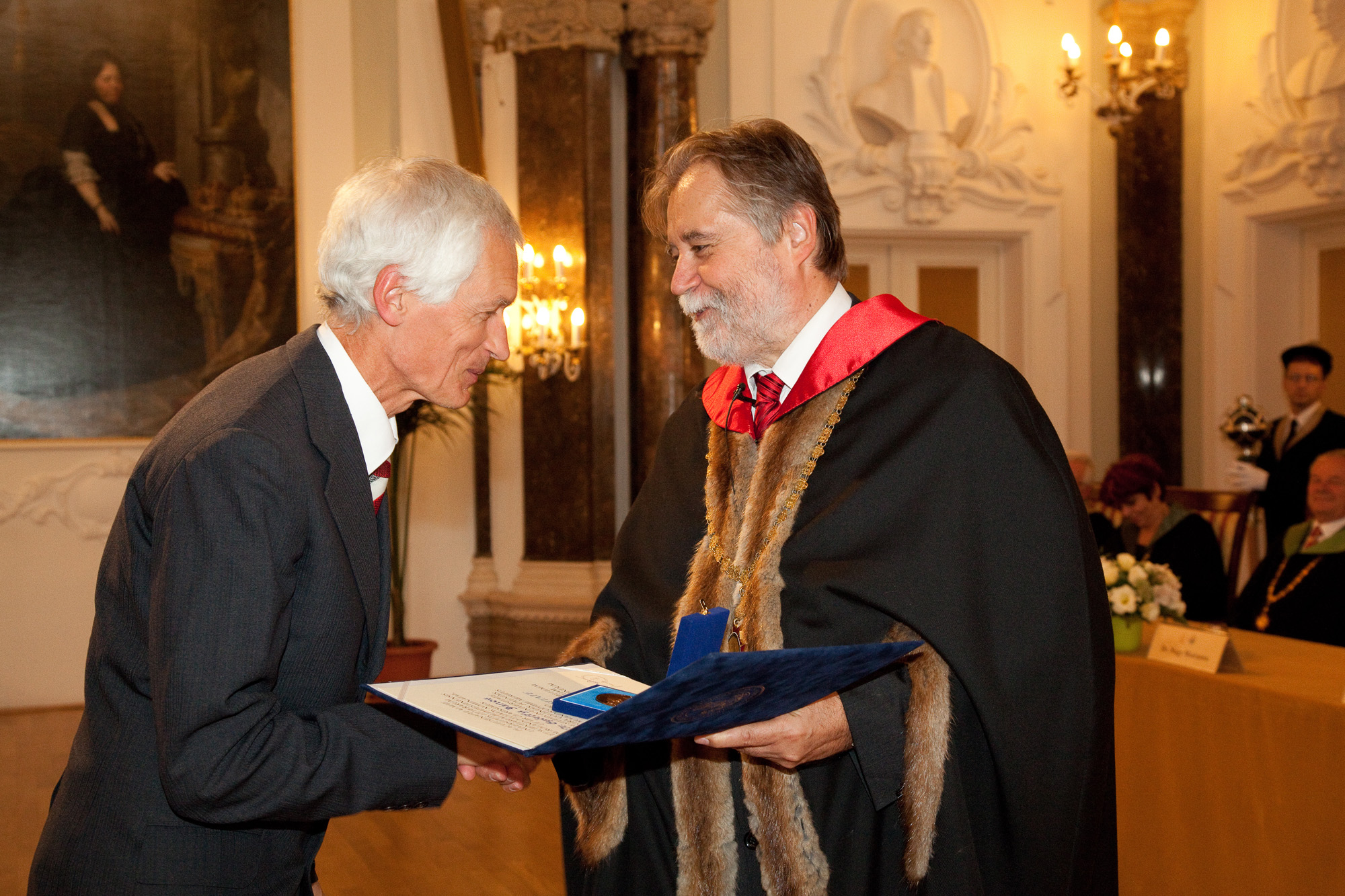
Zentai László received the Prize of Civilian Order from the Brazilian Cartographic Society in Rio de Janeiro. He gave a paper, Cartography on Eötvös University at the Federal University of Rio de Janeiro. |
IV. 18-19. |
National conference of undergraduate research at the Budapest University of Technology and Economics. Papers by cartography students: |
IV. 17-24. |
Irás Krisztina in Porto in staff mobility. Her lecture "Digital Methods in Cartographic Analysis" |
IV. 2. |
|
IV. 2-30. |
Bán Barna, an MSc student of tourism and regional development at the Babeș-Bolyai University spent a month at the Department |
III. 25. |
João Sarmento, a teacher of the Minho University, Department of Geography, gave two papers in his staff mobility programme: |
III. 24. |
Mészáros János gave a paper, Cartography in the space – Space in cartography at the European Space Expo in Budapest |
III. 22. |
|
III. 12. |
|
III. 11. |
Visit by Csütörtöky József, director of the Danube Museum in Révkomárom/Komarno and Szabó László photographer. They discussed the building of 3D globe models with Gede Mátyás, Márton Mátyás and Nemes Zoltán. They plan to use the results for the restoration of the museum’s Blaeu’s celestial globe of 1602. |
III. 8. |
Presentation of the ethnic atlas, „Changing ethnic patterns of the Carpatho-Balkan area” in the Academy. One of the presenters was Klinghammer István academician.
Session of the Doctoral School of Earth Sciences. New name of the PhD programme was accepted: Cartography-Geoinformatics |
III. 5. |
Bartos-Elekes Zsombor, PhD, teacher at the Babeş--Bolyai University in Kolozsvár/Cluj, our former student, visited the Department. He gave several lectures: |
III. 1.-IV. 30. |
Varga Andrea, a student of geography at the II. Rákóczi Ferenc Hungarian College visited classes at the Department |
II. 27. |
Klinghammer István, professor emeritus of the Department, became state secretary of higher education. |
II. 25-III. 17. |
Lengyel Hunor, a 3rd year geography student at the Babes--Bolyai University visited classes at the Department |
II. 7. |
The closing conference of the KMOP 4.2.1/B-10-2011-0002 project, “Interdisciplinary and innovative research, the development of the infrastructure background of industrial cooperation, and introducing new education technologies at ELTE”. Györffy János presented the purchases of the Faculty. Szekerka József showed the working of new equipment of the Department. |
II. 6. |
Workshop on open source geoinformatics at the BME. Participants from the Depaartment: Gede Mátyás, Mészáros János. |
I. 29. |
|
I. 28. |
BSc final exams |
I. 25. |
|
I. 24. |
|
I. 4. |
Györffy János and Zentai László participated in a conference dedicated to the memory of Hrenkó Pál |