XII. 20. |
The Department received two new scanners: Colortrac (A0), Epson (A3) |
XII. 18. |
Guillermo Perez and Pablo Leandro, Erasmus students from Spain, defended their degree thesis |
XII. 10-16. |
|
XII. 9. |
The Central Statistical Office and the Regional Statistics announced a project, Complex analysis of the spatial processes of the economy and society in Hungary. The award was established to the memory of Thirring Gusztáv. Barancsuk Ádám-Gyapay Borbála-Szalkai Gábor: From theory to practice: infinite ways of creating administrative districts received 3rd place. |
XII. 5. |
Márton Mátyás receives the Doctor of Academy degree from the president of the Academy |
XI. 30. |
Departmental conference on student research. Papers by the students: |
XI. 22. |
Open Day at the Faculty of Informatics. Participants from the Department: Mészáros János and Zsoldi Katalin. |
XI. 22-23. |
International Symposium on Service-Oriented Mapping in Vienna. Two PhD students participated: Orosz László és Simó Benedek. |
XI. 16. |
|
XI. 12-17. |
Elek István gave a paper as co-author in Doha (Qatar) at the 19th International Conference on Neural Information Processing (ICONIP 2012): Istvan Elek-Janos Roden- Binh Nguyen: Spontaneous Emergence of the Intelligence in an Artificial World. Elek István was also asked to chair a session. |
XI. 6. |
Klinghammer István gave a paper, Tóth Ágoston, a pioneer of 19th century Hungarian cartography, was born 200 years ago at a conference of the Institute and Museum of Military History. |
X. 25-30. |
Zentai László went on Erasmus staff mobility to Norway |
X. 21-28. |
Márton Mátyás as a guest professor gave lectures on Oceanography at Babeş–Bolyai University (Cluj-Napoca). Twelve students registered for this course. |
X. 19-21. |
|
X. 13-19. |
Gercsák Gábor participated in the meeting of geographers (Comland working group) of the International Geographical Union in Cagliari. He was asked to chair a session. |
X. 12-18. |
Gede Mátyás went on Erasmus staff mobility to Dresden |
X. 12. |
Török Zsolt gave a lecture, The developing town map when presenting the homepage map of Nagykáta |
X. 11-12. |
José Jesús Reyes Nunez represented the Department at the GDi FÓRUM 2012 - XVII. ESRI Hungary Conference and had a poster, “Children Map the World: notes on an international map drawing competition” |
X. 9-10. |
Zentai László gave two papers in Kozani, Greece: Greek communities/activities in Hungary at the opening of a map exhibition, Dytikomakedones and Kozani in Western Europe and in Hungary, and ICA: Modern cartography and GIScience at the 12th conference of Greek Cartographers |
X. 4. |
Data is Beautiful Conference. The Department was represented by Gede Mátyás, who gave a paper, Representation of the spatial distribution of geotagged photos |
IX. 28. |
Faculty of Science Open Day. Night of Researchers - the departmental programme: Prepare your own globe Zentai László gave a paper in Zagreb at the 8th Conference of Cartography and Geoinformatics: The development of modern map production: the example of topographic and orienteering maps |
IX. 24. |
Török Zsolt gave a paper, Travel in time with maps: the Danube 200 years ago at a meeting celebrating the 65th anniversary of a magazine, Life and Science |
IX. 16-18. |
Zentai László participated in an international research seminar of AutoCarto in Columbus (USA, Ohio). He had a paper, Does cartography still exist? |
IX. 9-12. |
30th IMCoS Symposium: 500 Years Mercator in Vienna. Török Zsolt gave a paper, 16th century fortification atlases of the Habsburg-Ottoman border zone. |
IX. 7. |
At opening ceremony of the academic year, Zentai László received the Memorial Medal of Eötvös Loránd University |
IX. 5. |
|
IX. 4. |
Opening ceremony of the academic year at the Faculty of Informatics |
IX. 3. |
Outdoors opening of the academic year by the Department in Pilismarót hosted by Elek István. |
IX. 1. |
Albert Gáspár, assistant professor, is a new member of the staff. Draskovits Zsuzsa retired. Two Erasmus students arrive at the Department: Guillermo Pérez Ortiz de Zárate and Pablo Landro Sobradilloe, to prepare their degree thesis supervised by Jesús Reyes. Outgoing Erasmus students: Joó Katalin (As, Norway), Kis Réka (Vienna), Szabó Miklós (Sofia) |
VIII. 22-25. |
Jesus Reyes participated in the symposium of the Education Commission of the International Geographical Union in Freiburg. He gave a paper with co-authors (Dombovári, E. S. and Garra, A. M.), Experimenting an Alternative Method of Representation In-School Cartography. |
VIII. 22-23. |
HUNGEO 2012, world meeting of Hungarian earth scientists
|
VIII. 1. |
Zentai László was named vice-dean of academic and international affairs |
VII.9.-13. |
Merk Zsófia, MSc student of cartography, participated in the meeting of the Planetary Mapping commission of the ICA in Moscow. She gave a paper, Map of Io. After the commission meeting, she participated in the summer university of the Moscow State University of Geodesy and Cartography (MIIGAiK). |
VII. 2-4. |
|
VI. 28-29. |
The 4th international symposium of the Commission on the History of Cartography of the ICA was organized by the Department.
|
VI. 27. |
Cartography from three continents - workshop at the Department:
|
VI. 25-27. |
BSc final exams |
VI. 21-24. |
Gercsák Gábor participated in the international symposium on Historical maps in environmental geosciences in Cluj-Napoca, Romania. He had a paper, Use of old maps in developing an environmental monitoring system. |
| VI. 21. | Final exam of students in the five-year training |
VI. 18-22. |
4th International Cartographic and GISA Conference in Albena, Bulgaria. Participants from the Department: Mészáros János, Jesús Reyes, Zentai László (teachers), Bakonyi Judit (student). |
VI. 16. |
Nights of Museums 2012 in the Map Room of the National Széchényi Library. The Department was represented by Dr. Kovács Béla (head), Gyöngyösi Ádám, Jesch György, Szepesi Petra and Ungvári Zsuzsanna BSc/MSc students, who gave presentations on the principles of GNSS, navigation tools, virtual Perczel's globe. |
VI. 7-8. |
Final conference of the Research University project in Visegrád. The Department was represented by Elek István and Jesús Reyes (teachers) and three students (Ungvári Zsuzsanna, Zsoldi Katalin and Szabó Csaba). The papers were as follows: 3D applications in cartography (Zsoldi Katalin), The virtual recreation of Blaue's globes (Ungvári Zsuzsanna) and The renewal of a Hungarian homepage on cartographic knowledge (Szabó Csaba). |
VI. 1-2. |
José Jesús Reyes Nunez participated in the conference, EUROGEO 2012 – Geography and Global Understanding: connecting the sciences in Dublin, at Patrick’s College, organized by the European Association of Geographers, EUROGEO. In the opening ceremony, he presented the activity of the International Cartographic Association and, on the second day, he gave a paper in the GIS section, “Visualizing geographic and thematic data in the MSc degree in Cartography at Eotvos University”. |
V. 24-25. |
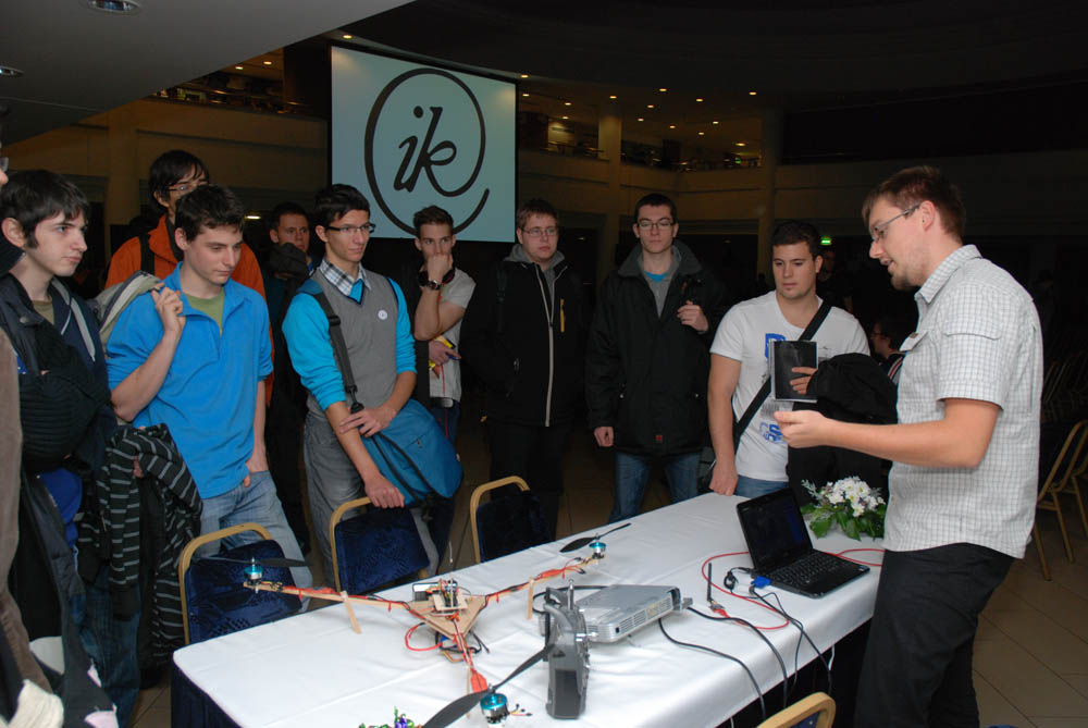
Mészáros János, assistant, gave a paper at the GIS conference in Debrecen, The hydrographic maps of Vályi Béla and their integration into a geoinformatic system, and had a poster, Drones in remote sensing (co-authors: dr. Zentai László and dr. Kovács Béla). |
V. 23. |
Gede Mátyás had a paper, 3D virtual model of a structural-morphological earth globe at the 27th annual conference of the Geoscience Information Consortium organized by the Hungarian Geological and Geophysical Institute |
V. 10. |
|
V. 9. |
Zentai László gave a paper (ICA and the modern cartography) and runs a workshop (Importance of visualization of maps and spatial data in management of national resources) in Tehran, Iran, at the 2nd International Conference and Exhibition on Mapping and Spatial Information (ICMSI 2012) |
V. 8. |
|
V. 7. |
Teachers (Gede Mátyás, Mészáros János) and students (Kádár Iván, Restás-Göndör Adrienn, Szabó Tímea, Ungvári Zsuzsanna, Varga Balázs) carried out a laser scanning survey in the Pál-völgyi Cave. The instruments were supplied by the GEO of the West Hungarian University (contributor: Nagy Gábor) and the GeoLink3D Co. (contributor: Nagy Attila). Consultant was Christin Petters, a student of the Technical University of Dresden. The processing of the data started, and the results can be seen at http://lazarus.elte.hu/cavescan/. |
V. 3. |
Springer publishes the volume, Online Maps with APIs and WebServices, which includes Gede Mátyás's paper, The Possibilities of Globe Publishing on the Web |
| V. 2. | Presentation of Rufino Perez Gomez, Erasmus exchange teacher from the Technical University of Madrid: 3D Modelling and Analysis with GIS and Google Earth |
| IV. 24-27. | AGILE conference in Avignonban. Irás Krisztina participated in the workshop, Hands-on "Open Source GIS & WebMapping". |
| IV. 20. | Professor Márton Mátyás received the title, Academic Doctor from the Hungarian Academy of Sciences. |
| IV. 19-20. | 7th International Workshop on Digital Approaches to Cartographic Heritage in Barcelona. Gede Mátyás represented the Dedpartment. His presentation with Mészáros János: The possible use of free on-line tools for digitizing old relief models. Gede Mátyás was head of section at the workshop, Map Libraries, Collections, Archives. |
| IV. 17. | PhD defence of Turczi Vanda |
| IV. 12-14. | Visit of Prof. Dr. Sara Irina Fabrikant, teacher from the Geography Department of the University of Zurich, head of the Geographic Information Visualization & Analysis (GIVA) centre, chairman of the Commission of Cognitive Visualization of the International Cartographic Association. He gave a paper, Creating Effective and Efficient Geovisualizations. |
| IV. 4. | Jeney János György, PhD student, gave a presentation of his research at the University of Zagreb, and studied the documents in the State Archhives of Zagreb. |
| IV. 3. | After long preparations, the computers and technical equipment were moved to new IP provinces. |
| IV. 1-6. | Márton Mátyás visited the Institute of Geography at Babes-Bolyai University in Kolozsvár/Cluj as an Erasmus teacher. He gave lectures to about 50 first year MSc students: Gazetteers of Hungary. He also presented two research projects of the Department: Virtual Globes Museum and the recreation of the globe of Perczel, and The century of Hungarian marine research (1913-2012). |
| III. 23. | Opening the Beautiful Hungarian Map exhibition |
| III. 21-22. | A 3. Hunagi Konferencián és szakkiállításon Mészáros János képviselte a tanszékünket. Előadásának címe: Személyzet nélküli légi járművek alkalmazása a földtudományokban
|
| III. 21-28. | Jesús Reyes Erasmus gave lectures at the Technical University of Madrid as an Erasmus exchange teacher. |
| III. 15. | Török Zsolt received the Fasching Antal award from the minister of Rural Development on 15 March. |
| III. 13. | PhD defence of Simonné Dombóvári Eszter
|
| III. 1. | Klinghammer István was elected Vice-President of the Hungarian Accreditation Committee |
| II. 27-III. 9. | Kurkó Mónika, a 3rd year student of geography at Babes-Bolyai University (Kolozsvár/Cluj) had a short study course at the Department |
| II. 1- | Mészáros János became a full member of the Department
|
| I. 30-II. 2. | Final exams: - BSc level - MSc level - 5-year training level |
| I. 27. | Open Day at the Faculty of Science |
| I. 26. | Open day at the Faculty of Informatics |
| I. 18. | Borja González-Redondo Ares, Erasmus exchange student defended his degree thesis |
| I. 4.- | Paulina Lemenkova, a PhD student of the Technical University of Dresden, spends four months on research at the Department. |