REPORT ON CARTOGRAPHIC EDUCATION IN AUSTRALIAN STATES
AND TERRITORIES
CARTOGRAPHY PROGRAMS
2002
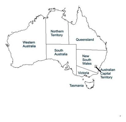
Provided below is a State/Territory breakdown of cartography and mapping science related programs available in Australia.
VICTORIA
RMIT University
Overview
The Bachelor of Applied Science in Multimedia Cartography focuses on the use of New Media for mapping and its related professions. It has been designed to enable students who are interested in multimedia, information technology, design, electronic publishing and geography to undertake a program that combines all of these skills areas to provide a program that focuses on innovation and unique solutions that enable better visualisations of the world we live in.
Duration - Three years full-time or six years part-time
A holder of the Bachelor of Applied Science in Multimedia Cartography is academically eligible for admission to the Institute of Mapping Sciences Australia (MSIA) and the Australasian Urban & Regional Information Systems Association (AURISA). Undergraduates are eligible for student membership of each of the above organisations.
Employment prospects in Multimedia Cartography cover a wide and varied field. Graduates are involved in developing geographic information systems, designing tourist guide publications, interpreting remotely sensed satellite images, producing topographic and base maps, compiling street directories, operating desktop mapping packages and developing computer mapping systems. They are employed by many private and public sector organisations.
Related Programs:
http://www.arts.monash.edu.au/ges/undergraduate/outline.html
http://www.geom.unimelb.edu.au/students/index.html
WESTERN AUSTRALIA
Department of Spatial Sciences
Bachelor of Science (Cartography)
Overview
The University offers a three year degree in cartography. In addition, a fourth year for honours in cartography is offered which leads directly into the Master of Science (Surveying and Mapping) and the Doctor of Philosophy (PhD).
Through the cartography degree program students gain expertise from a range of areas such as computing, environmental science, film and print technology, geography, geology, management, mathematics and physics as well as the more creative aspects such as art and design. Students will also learn how to interpret, store, display and manage data which is used in representing both the natural and cultural environment.
More information: http://www.cage.curtin.edu.au/spatial/ugrad.html
Professional RecognitionCartography graduates are eligible to apply for associate membership of the Institution of Surveyors Australia Inc (ISA) and the Mapping Sciences Institute, Australia (MSIA) and, after a period of work experience, may obtain full membership. While enrolled at the University, students are eligible for student membership of the ISA free of cost and of the MSIA at greatly reduced rates.
Career ProspectsCartographers are employed by local government and State mapping authorities, exploration and mining industries, environmental mapping agencies, and private mapping and town planning companies.
NEW SOUTH WALES
No Cartography courses available
Related Programs:
http://wwwdb.csu.edu.au/division/marketing/courses/undergrad/ug-scag/bbssin/bbssincsu.htm
http://www.mq.edu.au/study/areas/science/GIS/gis_adeg.htm
QUEENSLAND
No Cartography courses available
Related Programs:
http://www.dbe.bee.qut.edu.au/courses/#Surveying
http://www.tesag.jcu.edu.au/courses/undergrad.html#ugprograms
http://www.usq.edu.au/unit/70.htm
SOUTH AUSTRALIA
No Cartography courses available
Related Programs:
http://www.roseworthy.adelaide.edu.au/Campus/undergraduate_courses/booklets/BachNatResMgtcourses.htm
http://www.unisa.edu.au/courses/acrobatfiles.htm
TASMANIA
No Cartography courses available
Related Programs:
http://www.utas.edu.au/docs/geomatics/courses.html
AUSTRALIAN CAPITAL TERRITORY
No Cartography courses available
Related Programs:
http://www.ge.adfa.edu.au/ug.html
http://online.anu.edu.au/academia/graduate/programs/g1/
NORTHERN TERRITORY
No Cartography courses available
Related Programs:
http://mindil.ntu.edu.au/ntu/apps/coursere.nsf/vwURLCourse/GDGI20
CONFERENCES
Mapping Sciences Institute, Australia 2002 Conference, May 12 to 15, 2002
http://www.mappingsciences2002.conf.au/info.htm
The 11th Australasian Remote Sensing and Photogrammetry Association Conference, September 2 to 6, 2002
http://www.geosp.uq.edu.au/11arspc/overview.htm
AURISA Conference November 25 30, 2002
Australian Map Circle 2002 Conference July 14-17
www.australianmapcircle.org.au
MAPPING SCIENCES - PROFESSIONAL ORGANISATIONS IN AUSTRALIA
ˇ Australasian Urban and Regional Information Systems Association Inc. (AURISA)
ˇ Mapping Sciences Institute, Australia
ˇ The Remote Sensing and Photogrammetry Association of Australasia (RSPAA)
RESOURCES
EDUCATIONAL INSTITUTIONS RUNNING PROGRAMS RELATED TO THE MAPPING SCIENCES
ˇ Department of Civil Engineering and Surveying, University of Newcastle
ˇ Department of Geomatics, University of Melbourne
ˇ Department of Geomatic Engineering, University of New South Wales
ˇ Department of Geospatial Information, Royal Melbourne Institute of Technology
ˇ Department of Surveying and Spatial Information Science, University of Tasmania
ˇ School of Planning, Landscape Architecture and Surveying, Queensland University of Technology
ˇ Faculty of Engineering and Surveying, University of Southern Queensland
ˇ Faculty of Science, Australian National University, Canberra
MAPPING SOFTWARE IN COMMON USE IN AUSTRALIA
ESRI products, MapInfo, CorelDraw, Corel Photopaint, Microstation, AutoCAD, Flash, DreamWeaver, MacroMedia Flash
The Australian Spatial Data Infrastructure (ASDI) is a national initiative sponsored by ANZLIC (The Spatial Information Council) to provide better access for all Australians to essential geographic information (spatial data). In this way the ASDI will help sound decision making in supporting Australia's economic growth and its social and environmental activities.
Final Comment
Cartographic education in its purest form is only available at Curtin University of Technology in Perth and the RMIT University in Melbourne. The study of cartography, or at least some component of the mapping sciences, is found as part of the curriculum in many related undergraduate courses.
For further information please contact:
Dr. David Fraser
Member ICA Commission on Education and Training
MSIA Education and Training Program Manager
Department of Geospatial Science
Faculty of Applied Science, RMIT University
Tel +61 3 9925 3265 Fax +61 3 9663 2517