History of the CET
| 1964-1972 | Stephane de Brommer | (IGN, France) |
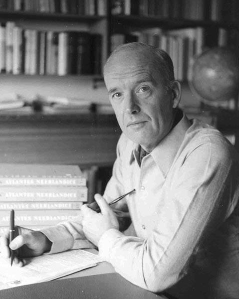
| 1972-1980 | Cor Koeman | (Univ. Utrecht, The Netherlands) |
| 1980-1987 | Karl-Heinz Meine | (Bodenkartierungsamt, Hannover, Germany) |
| 1987-1999 | Ferjan Ormeling | (Univ.Utrecht, The Netherlands) |
| 1999-2003 | Vladimir S. Tikunov | (M.V.Lomonosov Moscow State University, Russia) |
| 2003-2007 | Zentai László | (Eötvös University, Budapest, Hungary) |
| 2007-2012 | David Fraser | (RMIT University, Melbourne, Australia) |
| 2012-2015 | David Fairbairn | (Newcastle University, Great-Britain) |
| 2015-2019 | David Fairbairn | (Newcastle University, Great-Britain) |
Commission on Education in Cartography (25 year, International Cartographic Association, 1959-1984 edited by Ferjan Ormeling Sr.)
Out of the recommendations for Commission subjects, in 1964, the General Assembly selected three themes, which were considered vital for the further development of the profession: Training, Terminology and Automation. In all three sectors, interesting results were achieved, the highlights of which are recorded below, followed by a selection of other commissions.
At the time of the formation of the Association in the 1950's training and education in cartography was generally inadequate. Cartographic draughtsmen were usually trained on-the-job with minimal theoretical background knowledge. For the higher echelons, specialised education was generally non-existent, they were populated with "renegade" surveyors and geographers, who as immigrants brought the land under cultivation, awaiting, as it were, a new generation of pure cartographers.
From the outset, the Association realised that giving guidance in the upgrading and standardising of cartography education would be one of its main tasks. For that purpose the Commission on Training in Cartography (renamed Education in 1967 and Continuing Education in 1980) was established under Stéphane de Brommer, Director of the IGN Ecole Nationale de Sciences Géographique. De Brommer was an inspiring leader. He succeeded to assemble in his group a fine collection of experts from East and West. He presented his commission to plenary conference sessions in Amsterdam, New Delhi, Stresa and Ottawa, thus promoting widespread understanding for the subject of education. The start of his commission coincided with the arrival of the computer in map production. Since the demonstration of the Oxford System in London in 1964, it started to dawn on cartographers that to make optimal use of the new technology, additional training was needed. As computer technology in mapping further progressed, the call would become louder for new programme structures for various levels of learning and for "ideal" cartographers with sufficient knowledge to keep their foothold in a computer environment.
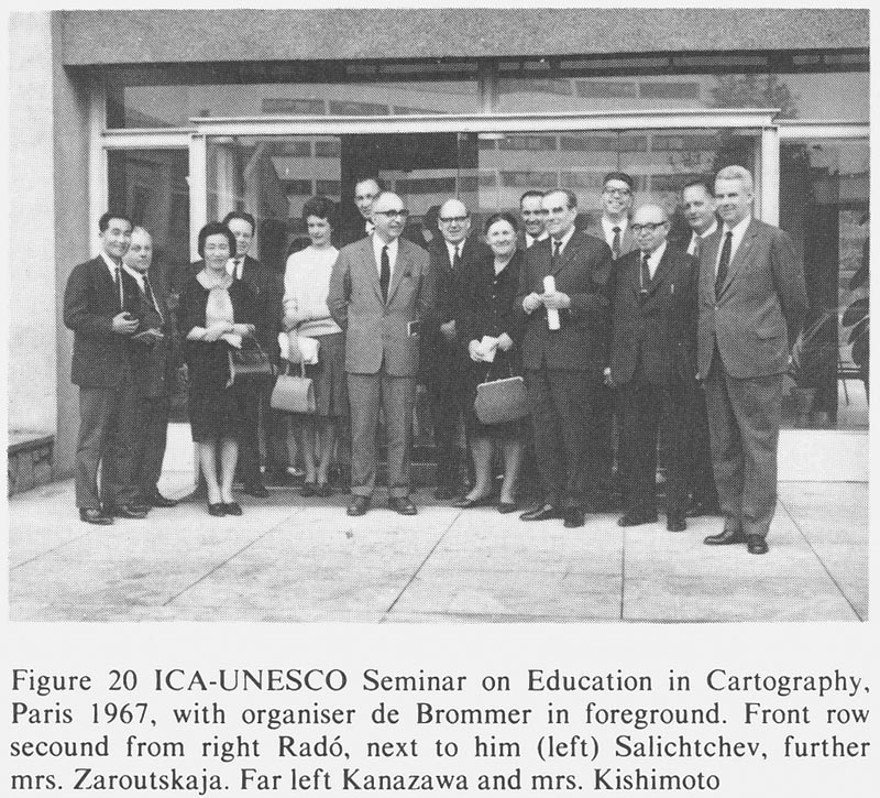
Before complying with these wishes the first step of the Commission was to acquire a better insight into the existing diffuse cartographic community, its structure and level of education. For this purpose, chairman de Brommer sent out three series of detailed bilingual questionnaires to hundreds of addresses, mapping agencies, government and private, university, institutions, individual cartographers etc.. Further, de Brommer succeeded in exciting the interest of UNESCO, Paris for his commission. With their financial support he organised three seminars on Education in Cartography at UNESCO Headquarters in 1966, 1968 and 1970 respectively. During the first of these meetings, the unavoidable discussion on the demarcation of the field to be covered by education, resulted in a general agreement on the definition of cartography as mentioned in Chapter I. Being the first - and so far only - official ICA attempt to stake out the discipline, de Brommer's definition was to make history. It was adopted by the conference at Amsterdam in 1967 and has served as ICA's trade mark since.
Additional definitions were adopted, constituting the bases for further work. Three kinds of cartographic activity were outlined: 1. Essential Cartography, called "W", 2. Activities affected by cartography, called "V" and 3. Activities related to cartography, called "Z". Within the first group four levels of training for professional cartographers were distinguished, designated from the highest to the lowest using the symbols W1, W2, W3 and W4. For a long time this classification in four levels was used in international literature on cartographic education, though the requirements employed in various countries for individual degrees were not the same. W4 is associated with the draughtsman or technician with sufficient knowledge and experience to produce at an acceptable speed, high quality, accurate originals to reproduction standards on various media, using different equipment. Category W3 issues the Diploma-Technician with sufficient practical and theoretical background to perform any task in the map drawing section. He is the cartographer "par excellence", the head of the drawing room and as such distributing, checking and supervising the work and being responsible for the time schedule. Step W2 produces the engineers in cartographic work and university graduates in cartography, while W 1 are the scholars in the field of cartography, the scientific or academic cartographers, geographical cartographers and cartographic engineers. Finally, three essential functions were distinguished, corresponding to different levels of education:
1. Functions of research, teaching or direction,
2. Functions of supervision, organisation and control of production,
3. Function of execution, varying in complexity.
In New Delhi (1968) the Commission presented the first results of its inquiry in the form of a Catalogue of Institutions providing Instruction in Cartography. This Catalogue revealed the astonishing fact that less than 50 years after the first academic programme in cartography was established, some 130 institutions provided instruction in cartography, including a great many at higher levels.
It was not surprising that the Commission was invited by the General Assembly in 1968 to pursue its interesting studies for another four years and to collect further information and to make appropriate recommendations. In Stresa (1970) the Commission distributed two new interesting publications: 1. Typical Syllabuses of Instruction for the education of cartographers, and International Bibliography for Education in Cartography, both based on the responses to questionnaires and on supplementary comments from Commission members. The Syllabuses contained a wide range of subjects for instruction of the "W" category of cartographers, including matters resulting from new developments such as automation and semiology, useful for all levels in different countries. The Bibliography listed some 150 works used in cartographic education at different levels in 22 countries. Works specifically intended for teaching cartography proper had been included in the first place, but they were few in number.
In Ottawa (1972) Professor Cor Koeman (Netherlands) succeeded Stéphane de Brommer as chairman of the Commission. When assessing the results of the latter's work it can be said that the great amount of information collected and his proposals on education in general and study programmes in particular considerably contributed to the insight into the structure and requirements of the cartographic community.
Before leaving, de Brommer summed up recommendations for future commission work:
1. Preparation of instruction manuals; a simple general one for W4 cartographers and separate more advanced manuals on different subjects for W3 and W2 students,
2. Comparison of education programmes at various levels in different countries,
3. Organisation of seminars for teaching staff,
4. Aid to developing countries.
At Ottawa (1972), the IVth General Assembly, considering that the discipline was in permanent development, decided that the Commission should continue its activities. Out of the above recommendations the following terms of reference were chosen:
1. To consider the possibility of the preparation of a Basic Manual for education in cartography at W4 level for international use,
2. To prepare a second edition of the Catalogue of Institutions and
3. To compile a list of manuals for education in cartography.
Under the new chairman, the Commission deliberately concentrated upon the compilation of the manual, which in view of the scarcity of textbooks in cartography at that time, was greatly welcomed. The start was full of promise. In three years the Commission reached agreement upon level - W3 instead of the proposed W4 - and the contents of the manual, planned to consist of a volume of nine chapters with about 250 pages, to be written by cartographers from different countries, ranging from France and Switzerland to Japan and Sweden, from UK and USA to the Netherlands, FRG and Bulgaria. UNESCO, impressed by the momentum of the project, paid US$ 4000.- to defray travel and preparation costs, holding out prospects for further grants. In 1976 at the Moscow Conference the first chapter of the manual, the one on map reproduction by Christer Palm (Sweden), was presented in printed form.
After Moscow, unfortunately, the momentum was lost and in the following years Koeman experienced the full weight of the problems connected with the compilation of a textbook with unpaid authors from different countries, with varying backgrounds and experience in cartography and with different local support. Long discussions were required to try to get authors organised, and to endeavour to maintain a common style in text and illustrations and to keep the level, quality and detail constant. Because not all authors were able to stick to their promises, progress slowed down and UNESCO, becoming impatient, stopped its financial support. In 1980 when Koeman retired from his University, and had to do without clerical support, the manuscript was still incomplete. Thus, the retiring chairman who started the strenuous task with much courage, had to pay the price for his ideals for an international approach.
In 1981, the Publication Committee (under Harold Fullard, UK) taking over the responsibility for the manual, decided to split it up into two volumes and to put up the more complete chapters as Volume I. It took another three years of publishing discussions, checking, page make-up, reproduction and printing before the plan could be realised. In 1984 Volume I of Basic Cartography for Students and Technicians saw the light, still an inspiring example of international cooperation, but, appearing on a market where textbooks in cartography were no longer scarce. In retrospect, it can be stated that the example of having a commission, or at least a number of its members, concentrate for a long series of years upon the compilation of a single publication, to the exclusion of all other activities, should not serve as a model. Those involved, including the Executive Committee, might have recognised that the cartographic community most of all needed short term guidance on how to adapt education to the changing requirements of the swiftly developing discipline.
Seeing the need for constant surveillance of education, the Commission was renamed "Commission on Continuing Education in Cartography" in 1980. Its chair was taken over by Dr. K.H. Meine, expert in cartographic education in the FRG, one of the few countries where the position of cartographic technician is legally recognised. At its meeting at Frankfurt am Main in 1981, the Commission abandoned the four levels of cartography education - W4 up to W 1 - introduced by chairman de Brommer in the 1960's, because of the difficulty in most countries providing education at these levels concurrently. Henceforth, the Commission distinguished two levels instead of four: cartographic technician (CT) and cartographic scientist (CS). Within the Commission, working groups were established to develop educational curricula for both levels, as well to give guidance for the long term continuing education, according to the terms of reference. Much energy of the commission was taken up by its second term of reference namely to prepare exercises to enhance the usefulness of the manual Basic Cartography. The preparation of the exercises was slowed down because of differences of opinion as to the type of exercises or map samples required. However, there was much appreciation of the Commission for providing a successful UNESCO-sponsored seminar for French speaking African participants in Rabat, Morocco in 1984. Its organisational work was carried out in cooperation with the Moroccan Conservation Fonciére et des Travaux Topographiques and the African Association for Cartography. The papers presented by members of the Commission, supplemented by a few guest lecturers, were published in a volume entitled Formation des Cartographer, the first ICA publication completely in French.
In 1984 the Commission, in view of the vital importance of education in cartography, was promoted to the level of Standing Commission. However, its activities are still weighed down by the commitment to complete the exercises for Basic Cartography, a heritage from the past.
Since the introduction of the computer many educational centres, academic and technical, have adjusted their programmes to cope with changing demands by introducing a multi-disciplinary approach, including computer technology. The problem of reconstructing cartography curricula, however, is still very much alive and gives rise to controversy. The question as to which elements of the traditional curriculum (drawing, handlettering) should be retaied when introducing new subjects, was the issue of the memorable epic discussion between Koeman (Netherlands) and Dahlberg (USA) at the Conference in Tokyo (1980). At the Perth Conference (1984) the call for cartographers understanding the entire mapping process and knowing how to handle spatial information by modern methods, was once more emphasized by various speakers. Bouillé (France), repeating what had already been said in different words introduced the "New Look" Cartographer who should be conversant with "geomatics" i.e.. a combination of geosciences, mathematics, informatics and statistics. Penetrating was the paper of Fraser Taylor who, argued that the technological changes had revolutionised cartography to such an extent that a "New Cartography" (term first used by Guelke, Canada) had emerged. This New Cartography required adaptation on a wide scale. So far - Taylor said - the cartographers' response to these challenges had been weak and unless the situation changed, computer scientists, computer graphics specialists and graphic designers would dominate the mapping scene. Cartographers beware! It is obvious that for a future ICA Commission on Continuing Education there is much to be done!